Sediment City
Landscape Architecture Core Studio IV | GSD | Spring 2013 | Group Project with Jenny Corlett
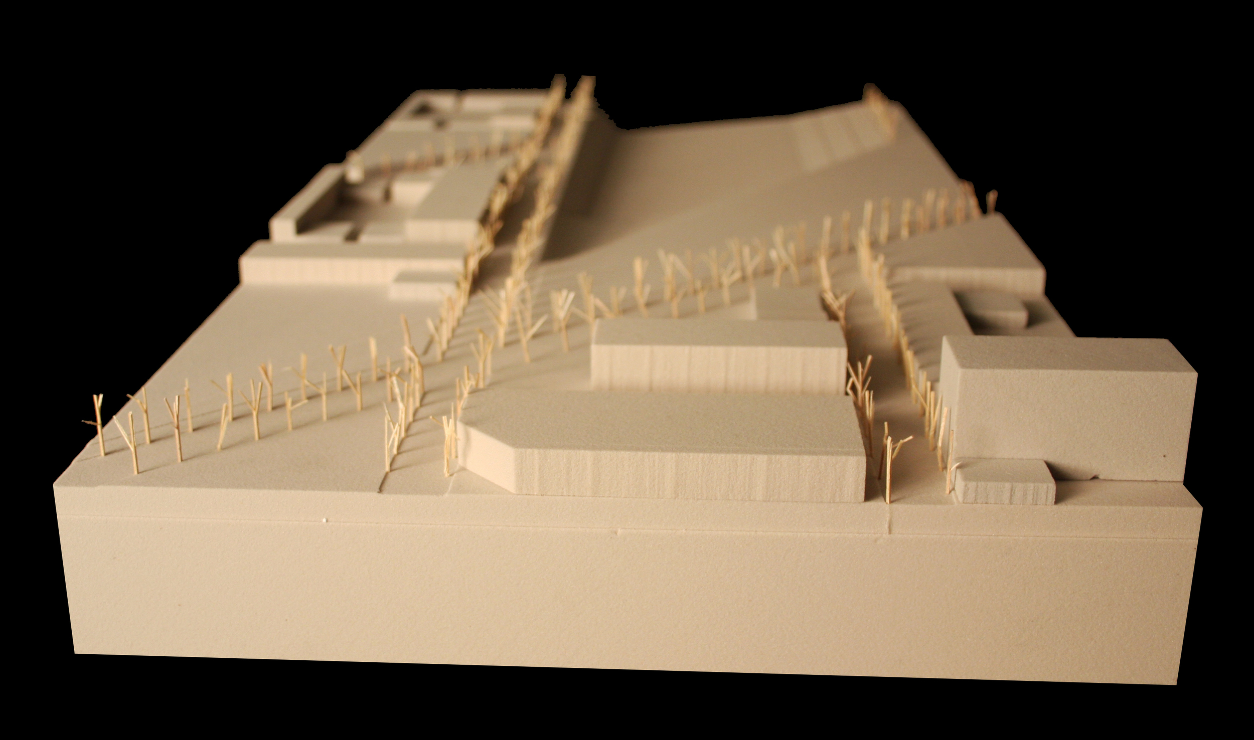
A chunk extending from the barrier islands to the housing on the peninsulas
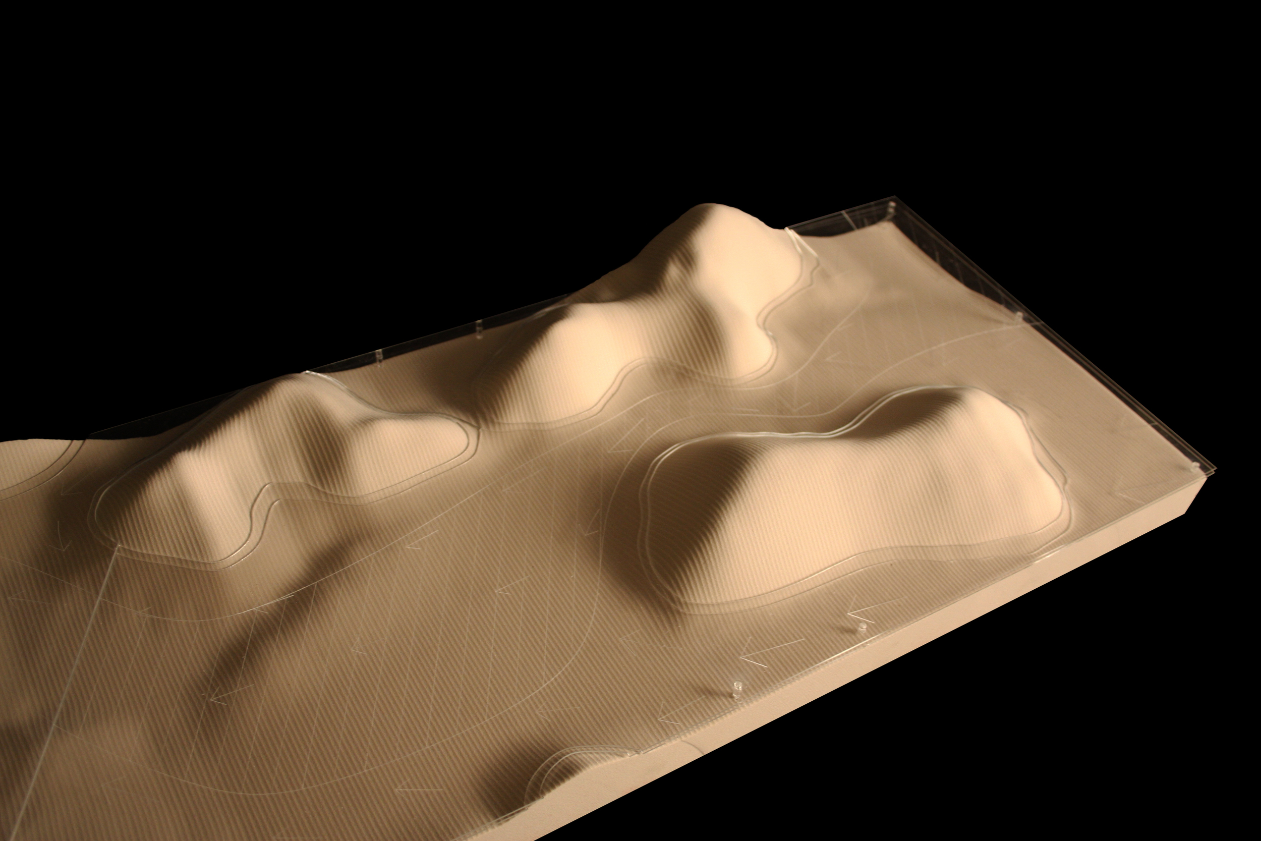
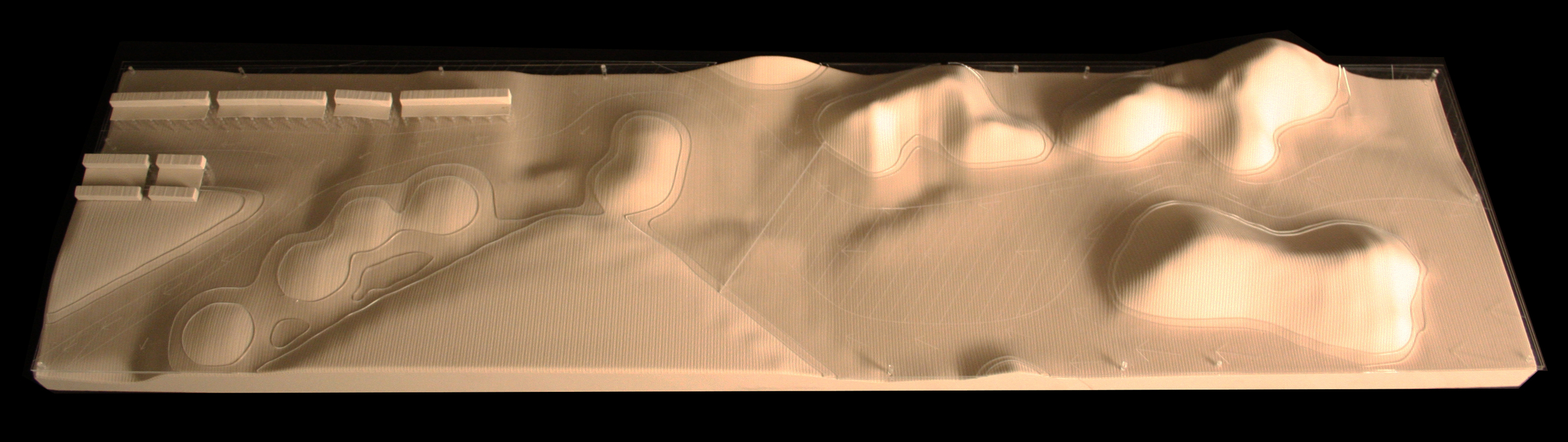
Sediment City uses dredge slurry for berm creation, shore protection, habitat restoration, land generation, and construction fill. Sediment City uses the vast amount of New York & New Jersey Harbor dredge material to raise the elevation of land intended for urban development, in anticipation of the increased frequency and intensity of storms and future sea level rise. To increase the area for future urban development, peninsulas are built out into the bay and an island archipelago is constructed to protect this urban growth. The barrier island archipelago acts as a wave attenuator, deflecting and reducing the energy of everyday and storm surge waves. Of these islands, one-third is reinforced and stationary in order to protect the bay and provide a multitude of habitats. The remaining two-thirds fluctuate, changing shape, size, and material. The reinforced archipelago islands are composed of a mixture of dredged material and soil stabilizers, allowing these islands to break the force of the currents and calm the waters inside the bay. The fluctuating islands are made solely of dredge material and react to larger erosive forces and the influx of new dredge material.
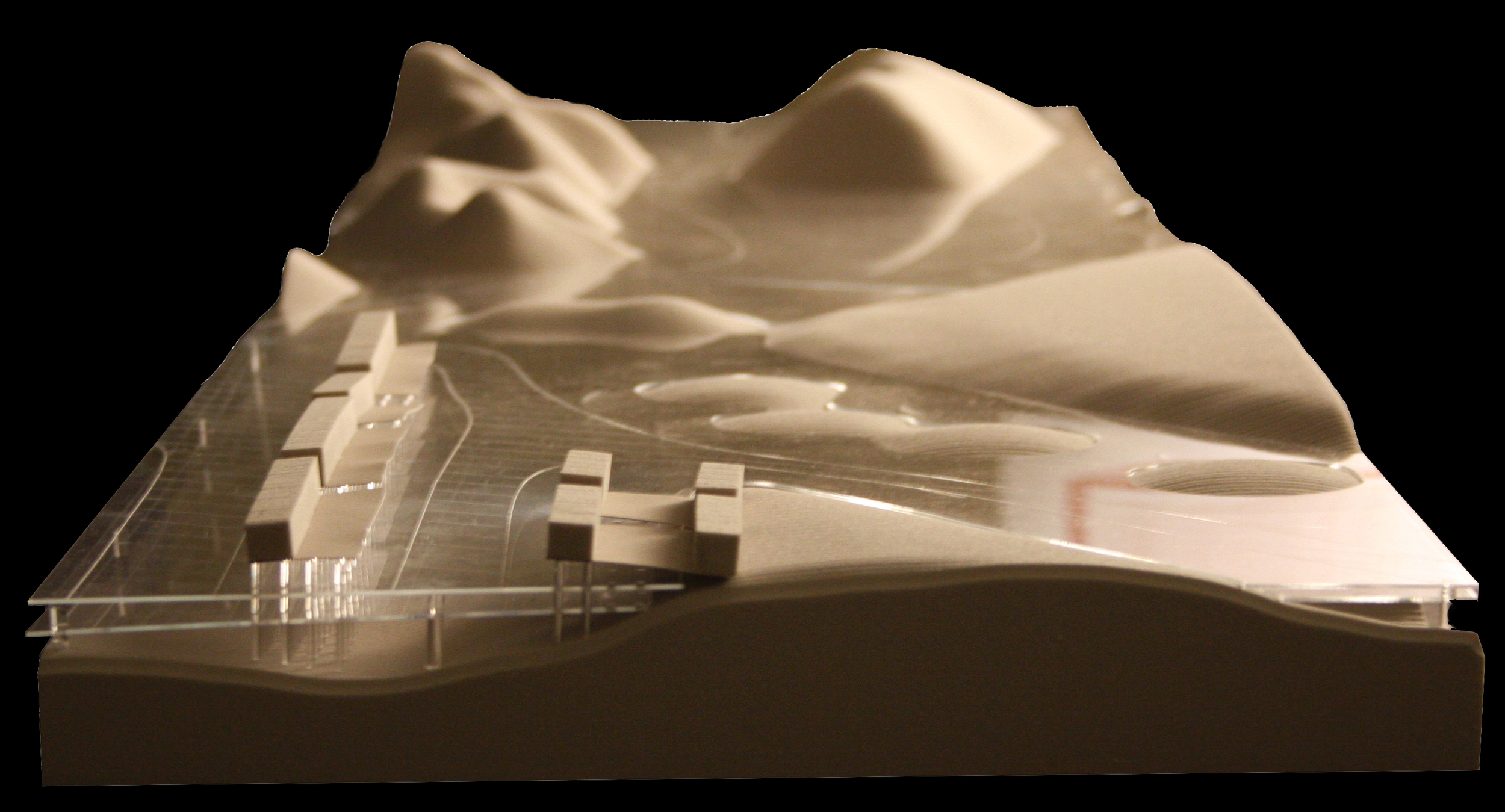
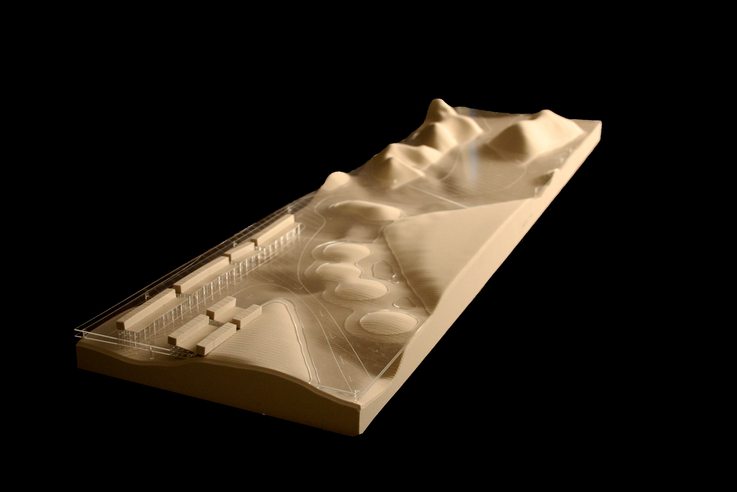
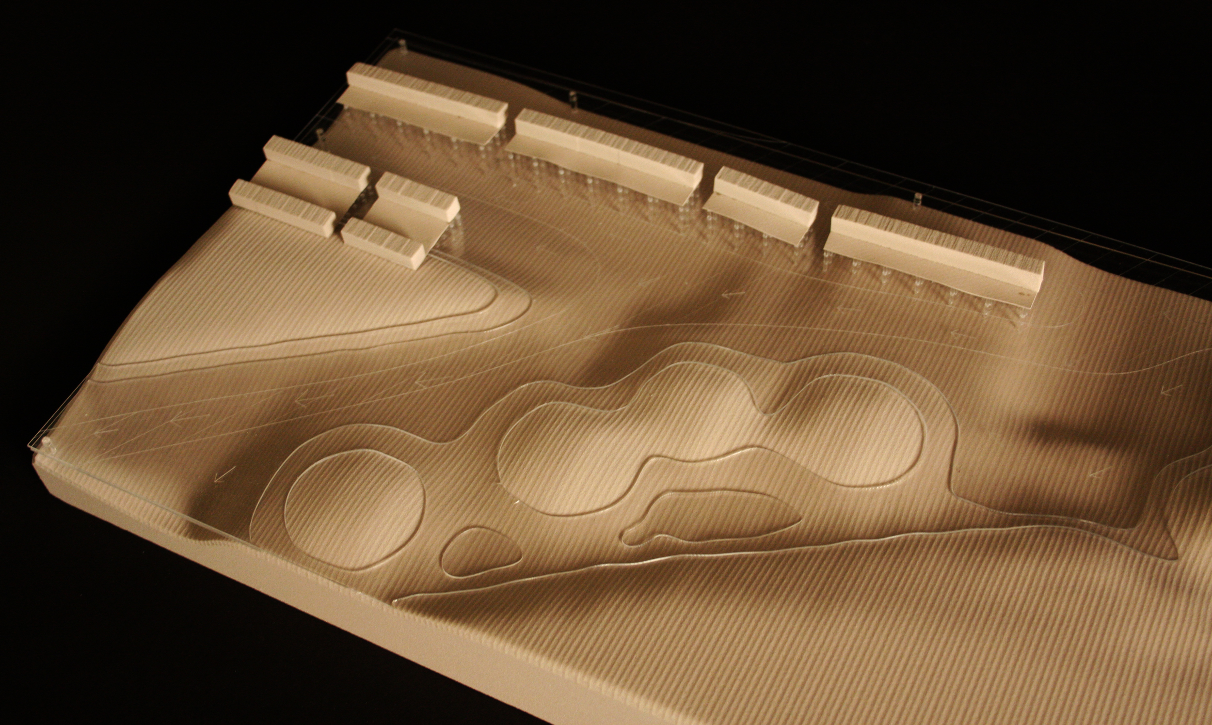
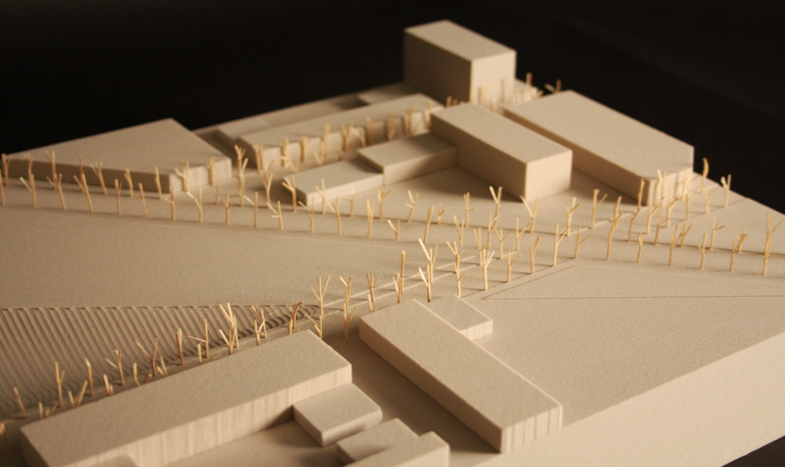
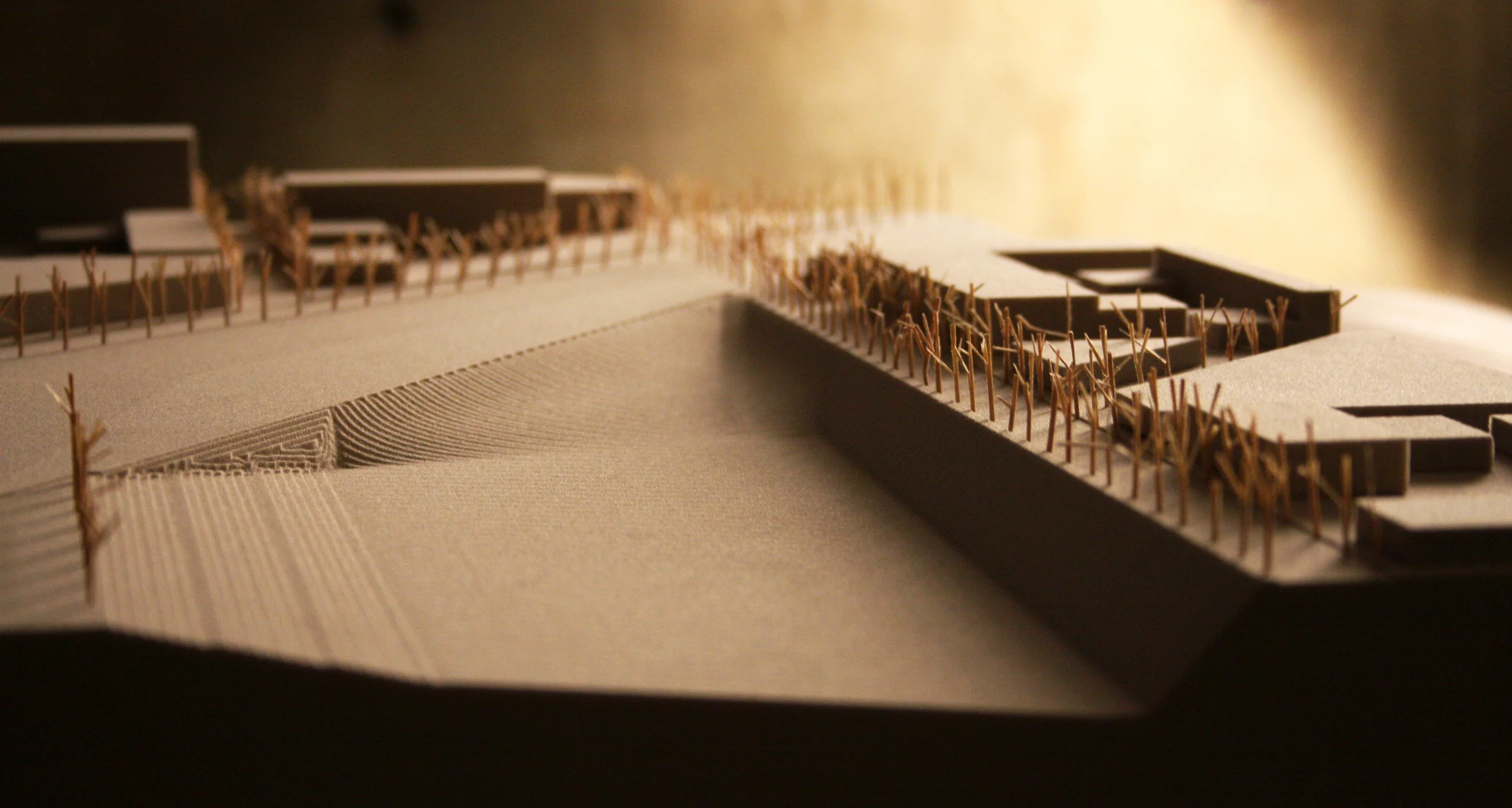
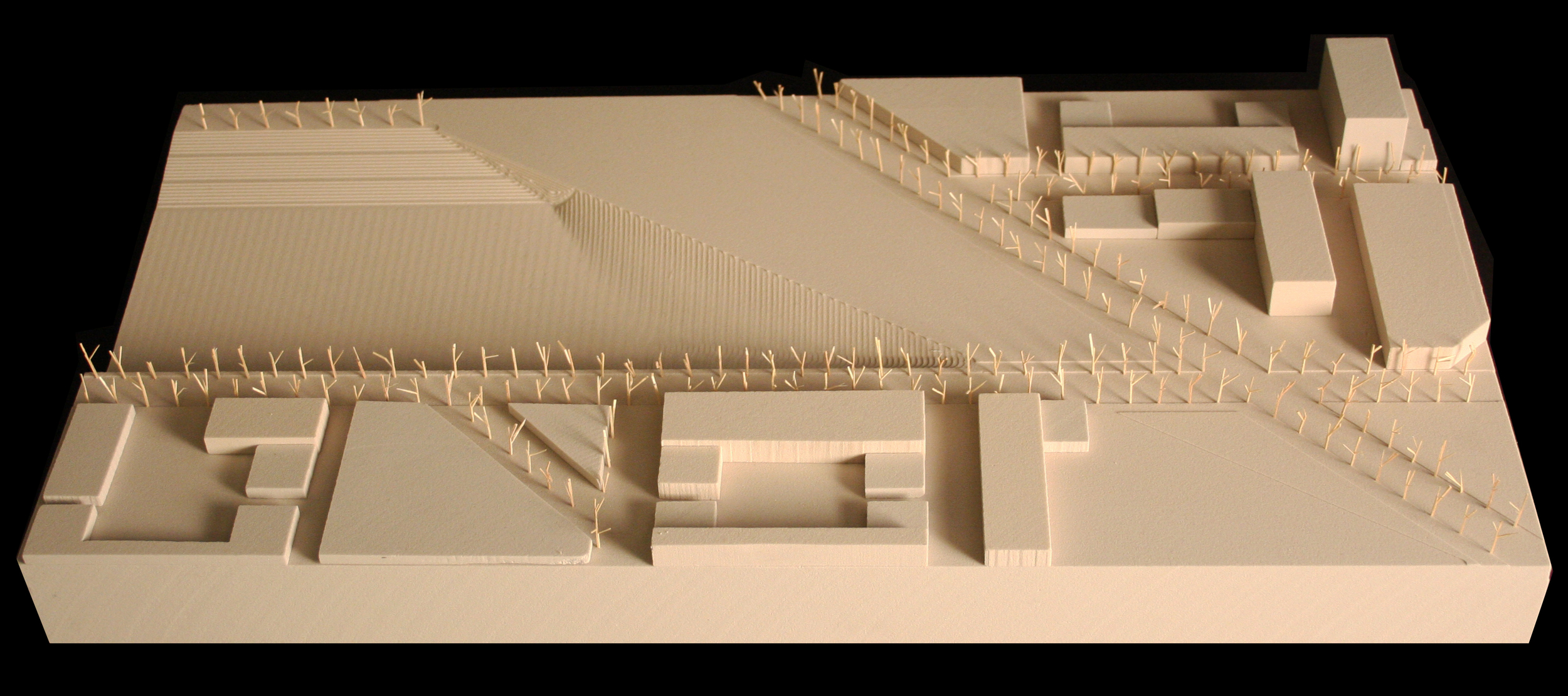
The urban fabric is based on the Brooklyn city block, but the strict linearity of the grid morphs in response to the new peninsula extensions, creating a flexible urban fabric. Building massing is designed to maximize the amount of publicly accessible space. Waterways and inlets puncture the urban fabric to elongate the shoreline. These punctures play a critical role in mitigating storm surge and flooding, as the edges are built to sustain tremendous impacts through various techniques of constructing hard and soft edges. These techniques include reinforced barrier islands (shock absorbers), shoals, riprap, marshes, and forested wetlands for wake dissipation. Sediment City explores ways of productively utilizing dredge material to generate urban regions capable of coping with sea level rise, the increased frequency and intensity of storm surge, and material flux in New York City.
This dredge flow diagram shows the cyclical nature of the dredging process.
The New York Bight (the 90 degree angle that is created by the Long Island and New Jersey shorelines) creates extensive erosion from the tides and currents throughout the New York and New Jersey Harbor. This perpetuates the need for dredging in the harbor.
The New York & New Jersey Harbor carries out extensive dredging each year to continue functioning as a competitive harbor on the east coast. In addition, the majority of dredged material is placed directly into local landfills as there is no perceived use for the material currently.
Operations for dredging and formations for dredge islands.
The sections look at the formation of the islands and peninsulas from the dredge material. In addition, they show the relationship between the housing, buildings, ground, and water.
Landscape and Infrastructure Catalogs
Building Catalog
Four series of 'walk throughs' were designed to describe the transition between the urban fabric, the peninsulas, and the barrier islands. Each walk focuses on a different aspect of the project: 'To the Tops of Mountains' begins in the urban fabric takes you across multiple bridges and to the top of a barrier island; 'Tree Hike' follows a path inward from the barrier islands to a central courtyard of one building; 'A Snow Day' looks at the variety of activities available; and finally 'The Out & Back Day Trip' follows the supposed path of a family going out for a picnic on a Saturday.
Generative Framework
Site Plan